

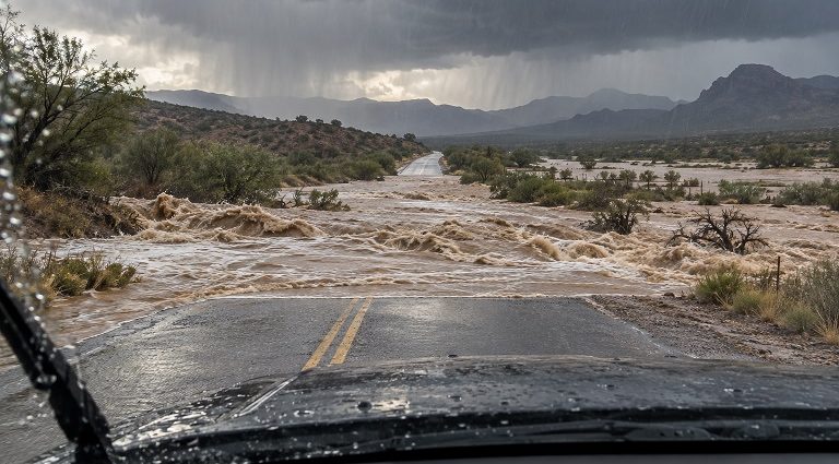
DEMING – Southwest New Mexico is under a flood watch from noon Monday, Sept. 28, through late Tuesday night as tropical moisture moves into the region. Repeated rounds of heavy rain could send fast-moving water through arroyos, streams and low-water crossings, even where little rain is falling nearby.
The watch covers Luna, Grant, Hidalgo, Sierra, Doña Ana and Otero counties, including Deming, Silver City, Lordsburg, Columbus, Truth or Consequences, Las Cruces and Alamogordo. Moisture moving north ahead of the weakening Tropical Cyclone Polo is expected to bring widespread showers and thunderstorms Monday and Tuesday. Repeated storms could produce up to four inches of rain in some locations. Rain from last week has already saturated the ground, increasing the flood risk.
Water can rush through a dry arroyo after a storm falls upstream. Familiar low-water crossings can become impassable quickly, while rivers, creeks and streams may continue rising after the rain ends. Runoff could keep the flood threat elevated into Wednesday morning.
The danger extends across much of New Mexico. Flood watches include areas from the Four Corners and Rio Grande Valley to the eastern plains and southeast. Many places could receive one to three inches of rain through Wednesday, with isolated totals of four to six inches. Those are forecasts, not amounts expected in every community. The greatest impacts will depend on where bands of heavy rain repeatedly develop.
Rain is expected to spread across western and northwestern New Mexico Monday afternoon, then move into central areas Monday evening and overnight. Another period of heavy rain is possible Tuesday and Tuesday night as Polo’s remaining moisture moves across the state. The exact path of the heaviest rain remains uncertain.
Parts of New Mexico have already experienced flooding this month. Emergency management reported flash flooding in the Ruidoso area on Sept. 16. On Sept. 24, flooding along the Rio Bonito from Lincoln toward Hondo prompted evacuations and a flash flood emergency. The Ruidoso area and other wildfire burn scars remain particularly vulnerable to intense rainfall.
A flood watch means flooding is possible. Residents should monitor weather alerts, stay clear of arroyos and streambeds during storms, and never drive or walk through floodwater. Anyone in a flood-prone area should be prepared to move to higher ground if a warning is issued.
John Krehbiel – Bravo Mic Communications News, LLC – John@Bravomic.com